Map - Manta, Cundinamarca (Manta)

Manta (Manta)
Manta is a municipality and town located in the northeast of the department of Cundinamarca (Colombia), 90 km from Bogotá. It is located in the Almeidas Province in the Tenza Valley. Manta borders to the north Tibiritá, to the west Machetá, to the south Gachetá and to the east Guateque and Guayatá of the department of Boyacá.

Manta in the Chibcha language of the Muisca means "to your tillage" or "your farmfields". This name comes from the ancient indigenous people who inhabited the territory of the Muisca Confederation. Another Muisca name that remains is the name of the vereda Fuchatoque, located on the eastern side of the city center, headquarters of the former cacique with the same name.
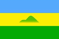
 
Map - Manta (Manta)
Map
Google - Map - Manta, Cundinamarca
Google
Google Earth - Map - Manta, Cundinamarca
Google Earth
Nokia - Map - Manta, Cundinamarca
Nokia
Openstreetmap - Map - Manta, Cundinamarca
Openstreetmap
Map - Manta - Esri.WorldImagery
Esri.WorldImagery
Map - Manta - Esri.WorldStreetMap
Esri.WorldStreetMap
Map - Manta - OpenStreetMap.Mapnik
OpenStreetMap.Mapnik
Map - Manta - OpenStreetMap.HOT
OpenStreetMap.HOT
Map - Manta - CartoDB.Positron
CartoDB.Positron
Map - Manta - CartoDB.Voyager
CartoDB.Voyager
Map - Manta - OpenMapSurfer.Roads
OpenMapSurfer.Roads
Map - Manta - Esri.WorldTopoMap
Esri.WorldTopoMap
Map - Manta - Stamen.TonerLite
Stamen.TonerLite
Country - Colombia
Currency / Language  
ISO Currency Symbol Significant figures
COP Colombian peso $ 2
ISO Language
ES Spanish language
Neighbourhood - Country  
  •  Panama 
  •  Brazil 
  •  Ecuador 
  •  Peru 
  •  Venezuela 
Administrative Subdivision
City, Village,...